Using AI to enhance satellite imagery to monitor our planet

Designing and operating Earth observation satellites involves trade-offs between the size, cost and quality.
In summary
- An international team led by Swinburne has developed a new method to assess different satellite designs using a powerful AI technique
- The AI-powered method reduces the cost of Earth Observation satellites while keeping the quality of images high
- Designing and operating Earth observation satellites typically involves trade-offs between the size, cost and quality
A new method to assess different satellite designs using a powerful AI technique to more cheaply monitor our planet from space has been released.
Thanks to an international team led by Swinburne University of Technology and leading provider of global Earth observation data, Planet Labs, the AI-powered method reduces the cost of Earth Observation satellites while keeping the quality of images high.
Traditionally, designing and operating Earth observation satellites involves trade-offs between the size, cost and quality of different hardware options.
Dr Steve Petrie, Earth Observation Research Fellow at Swinburne, was part of the team developing the innovative method.
“We used AI to compensate for compromises limitations in satellite hardware that degrade the quality of images,” he says.
“The glass lens was the most difficult component to compensate for, suggesting that satellite designers should not compromise on the quality of the lens relative to the quality of other components.”
Taking images of the Earth's surface is important for many applications, from monitoring climate change and biodiversity loss, to tracking extreme events like bushfires and floods.
Lowering the cost of Earth observation satellites will allow better tracking of these important phenomena.
Professor Alan Duffy, Swinburne Pro Vice-Chancellor of Flagship Initiatives says, “the new method demonstrates how AI can enhance images of Earth beyond the limits of the satellites themselves”.
“This provides higher-quality data with potentially lower-cost satellites and can help drive the uptake of Earth Observation as a tool for everything from agriculture to mining.”
“Swinburne is proud of the close collaborations it has nurtured with industry. This project is a wonderful example that brings together the best of Swinburne’s Space Technology and Industry Institute researchers as well as leading Earth Observation companies like Planet Labs and EY to show how space can be used to help Earth.”
Dr Petrie hopes that the research collaboration with Planet Labs and EY can be further developed on future satellite-focused research projects.
“The project gave us experience in using AI to enhance satellite images, and those techniques can potentially be used across several Swinburne projects that involve satellite imagery.”
-
Media Enquiries
Related articles
-
- Astronomy
- Film and television
- Social Affairs
MTC Future Aspirations camp blends STEM and Indigenous culture
The Moondani Toombadool Centre hosted 25 Aboriginal and Torres Strait Islander high school students at its recent Future Aspirations Camp, where it blended cultural activities with university experiences
Monday 02 March 2026 -

- Astronomy
- Technology
- Health
- Science
- University
- Sustainability
- Engineering
Swinburne highly cited researchers reach the top in 12 fields
Ten Swinburne academics have been named on the Highly Cited Researchers 2025 list, released by Clarivate
Tuesday 02 December 2025 -

- Astronomy
- Technology
- Science
- Engineering
Meet Swinburne’s Roo-ver Mission team
Roo-ver will be Australia's first lunar rover, and it’s being designed, built and tested in Australia. Swinburne is playing a key role in the design and construction of Roo-ver, through its involvement in the ELO2 Consortium.
Wednesday 26 November 2025 -
- Astronomy
- Technology
- Science
- Aviation
- Engineering
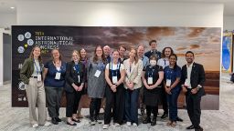
Shaping space innovation at the International Astronautical Congress
The 76th International Astronautical Congress (IAC) united over 7,000 delegates from more than 90 countries to explore the future of space. Swinburne staff and students delivered 20 talks, panels and presentations, showcasing Australia’s growing leadership in research and education.
Friday 10 October 2025 -
- Astronomy
Indigenous students explore the cosmos through Swinburne’s astrophysics program
Indigenous students explored astrophysics at Swinburne, connecting science and culture while building pathways to future careers in STEM.
Friday 19 September 2025


