
The iHUB National Urban Research Platform (iHUB) is a nationally networked platform of urban research laboratories located at Swinburne, the University of New South Wales, University of Queensland, Monash University and Curtin University. It delivers superior computational, visualisation and broadband communications capable of supporting a broad spectrum of real time, distributed, collaborative built environment and design activities. These activities can involve multi-disciplinary researchers, multiple tiers of government, cross-sectoral industry and the community.
Imagine politicians, planners, developers, architects, engineers, social scientists and citizens being able to gather in a room to make collective decisions based on real-time data analytics. That's what makes iHUB a game-changer — it provides a smart, networked, decision-supporting platform that enables participants to cast their work directly onto the iHUB ultra-HD canvas space for smooth and simultaneous viewing, mark-up and discussion by any (and all) national iHUB participants, no matter their device or location.
Swinburne’s iHUB Lab offers a highly flexible space for collaboration that supports all types of interdisciplinary engagement related to the planning and governance of cities and their built environments. These range from the national/global grand challenges associated with the UN Sustainable Development Goals (requiring large scale mission-oriented transformative R&D), to local planning, design and community engagement associated with precinct redevelopment and change (enabling transition to more sustainable neighbourhoods; the building blocks of cities).
iHUB’s physical layout of tables and screen arrays can be rapidly reconfigured to support different modes of collaboration, including lecture mode for presentations and guided discussions, breakout mode for focus groups and small sub teams, and boardroom mode for roundtable discussion.
Our partners
The iHUB National Urban Research Platform resulted from a successful $1.8 million LIEF grant awarded by the Australian Research Council (ARC). Swinburne is the lead institution in a consortium of universities that includes the University of New South Wales, University of Queensland, Monash University and Curtin University.


Our operational layers
Each iHUB facility in the initial 5-node network has four integrated operational layers that deliver its full functionality.
An iHUB facility provides a highly adaptable space where visual-analytic material from many sources can be used to cover a landscape of disciplines with vastly different modus operandi but where the visual representation of ideas, theories, facts, postulations, models and scenarios is the most appropriate common ground upon which to be informed, to negotiate, to advocate, and to instruct.
These features include:
a reconfigurable meeting space to support different modes of collaboration including lecture mode for presentations and guided discussions, breakout mode for focus groups and small sub teams, and boardroom mode for roundtable discussion.
a set of four ‘Pods’ (a ‘canvas’, ‘wall’ or ‘pin-up-board’) each comprising of eight 4K monitors that can host exhibitions drawn from various sources.
high-speed connectivity and computer processing with advanced graphics capability and the power to crunch large urban data sets, producing spatial visualisation in real-time while making use of all combinations of screens.
capability for visualisation of multiple media presentations from multiple devices, viewed simultaneously.
a ‘digital workbench’ for many powerful digital urban analytical tools that, to date, have not been able to interoperate. The digital workbench enables design decision-makers to consider fresh data-driven scenarios together with future planning scenarios in real-time.
Through sophisticated data capture, transmission and advanced analytics, and advanced visualisation, experts and end-users can interact with both the data and each other in real-time.
The data layer will operate as a distributed data system that draws on proprietary databases developed and managed within partner organisations and their affiliated networks, as well as those with open access managed by governments and agencies, such as AURIN.
The software layer represents a significant repository of computer-based tools developed by the iHUB university partners who have all been involved in one or more of the four urban Co-operative Research Centres (CRCs) — Construction Innovation, Spatial Information, Low Carbon Living and Water Sensitive Cities, as well as those available as open-source.
Computer modelling of built environment performance (at building, precinct and city scale) is extensive but currently exist as separate tools. iHUB presents an opportunity for creating capacity for integrated urban systems analysis and modelling.
The engagement layer is where the principal benefits of the iHUB network are delivered. Imagine politicians, planners, developers, architects, engineers, social scientists, and citizens being able to gather in a room to make collective decisions based on real-time data analytics. In such a facility, key stakeholders, experts and end-users could probe ‘what if?’ scenarios using 3D simulation to demonstrate the effects of competing urban development possibilities. The collected diverse disciplinary expertise and interests could debate alternative speculations around future cities together and consensually decide appropriate courses of action. There has been no such facility in Australia to date.
iHUB will enable ‘city as laboratory’ to be realised on a national scale, linking individual university labs as a single collaborative research space (including Swinburne’s Smart Cities Research Institute and Centre for Urban Transitions; UNSW’s City Analytics Lab and Urban Pinboard; Monash University’s Urban Lab; Curtin’s Circular Economy Living Lab; and University of Queensland’s individual research centres in the Faculty of Engineering, Architecture and IT).
This represents a future urban governance decision-making platform for local as well as metropolitan development policy-making, plan-making and place-making that could be transformative. For the first time, key decisions can be tested for likely consequences in real-time. This enables all stakeholders to be present, sharing information and a wide assortment of insights with a fluency and timeliness only made possible by the confluence of rapidly improving computing technology and processes, and combining these with distributed urban analytics and design software.
-
 iHUB's lecture configuration option
 -
 iHUB's research breakout configuration
 -
 iHUB Laboratory’s 4 visualisation pods
 -
 software identifying properties with high redevelopment potential") Envision Scenario Planner (ESP) software identifying properties with high redevelopment potential
Envision Scenario Planner (ESP) software identifying properties with high redevelopment potential -
 precinct design software illustrating massing, land use and probable emissions") Envision Scenario Planner (ESP) precinct design software illustrating massing, land use and probable emissions
Envision Scenario Planner (ESP) precinct design software illustrating massing, land use and probable emissions -
 Building design visualisation
 -
 Citizen-oriented modelling of actual and perceived origins of shadows in urban environments through a low-overhead online design computing tool
 -
 Exploiting gaming technology to develop an agile and extensible urban simulation testbed with synthesis of multiple streams of open data
 -
 Digital thermal comfort modelling
 -
 Aerial view of the ‘Implementing The Rhetoric’ project for the 2010 Venice Biennale — Harrison and White with Nano Langenheim and Flood Slicer
 -
") Light based modelling for View Quality measurement (view of water)
Light based modelling for View Quality measurement (view of water) -
 Flinders Street Station Redevelopment design competition — Harrison and White


 software identifying properties with high redevelopment potential")
 precinct design software illustrating massing, land use and probable emissions")


")

How you can be involved
The initial five-partner iHUB university network can be scaled up to include other university urban research laboratories, Australia-wide. It can facilitate remote participants from:
government departments
architecture, planning, engineering and construction organisations
NGOs
community organisations.
Essentially, iHUB is a fundamental new management platform for national collaborative research facilities such as CRCs and national environmental science programs where there are major efficiencies to be gained in program management, project initiation and management, distributed stakeholder engagement and new knowledge dissemination. If this sounds like you, contact us by emailing ihub@swin.edu.au to find out more about accessing iHUB.
Our equipment
The iHUB platform is networked for video, audio and big data, enabling teams of urban researchers, practitioners and community members from across four Australian states to collaborate. The equipment listed in the table is installed in the iHUB platform nodes, enabling synchronous high-speed engagement across the national network.
| Software | SAGE2 |
|---|---|
| SAGE2 server hardware | Alienware Aurora R9 Dual NVIDIA(R) GeForce RTX 2080 SUPER(TM) 8GB GDDR6 (OC Ready) with NVIDIA NVLink SLI(R) Enabled |
| AV equipment | 16 x 65" 4K LCD Display |
| 75" Interactive LCD Monitor | |
| Tracking PTZ Camera | |
| 4 x All-in-one Web Conferencing Unit | |
| Custom Trolley System for 4x65" Displays in Portrait |
Our collaboration within Swinburne
iHUB supports collaborative research within the following Swinburne research institutes and centres.
-

Innovative Planet Research Institute
-

Centre for Design Innovation
-
Centre for Sustainable Infrastructure and Digital Construction


Our people
-
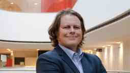
Professor Marcus White
Deputy Director, Centre for Design Innovation; Core Program Director, Urban Design Architecture -
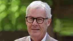
Professor Peter Newton
Research Professor in Sustainable Urbanism, Centre for Urban Transitions -
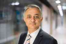
Professor Hussein Dia
Chair, Department of Civil and Construction Engineering; Program Leader, Smart Cities Research Institute


Interested in iHUB?
To find out more about iHUB or to collaborate with us, contact ihub@swinburne.edu.au.